Puro
By directing 2% of sale proceeds of Puro coffee to World Land Trust, more than 100,000 acres of rainforest in coffee producing countries has been purchased and permanently protected.
Coffee and Conservation
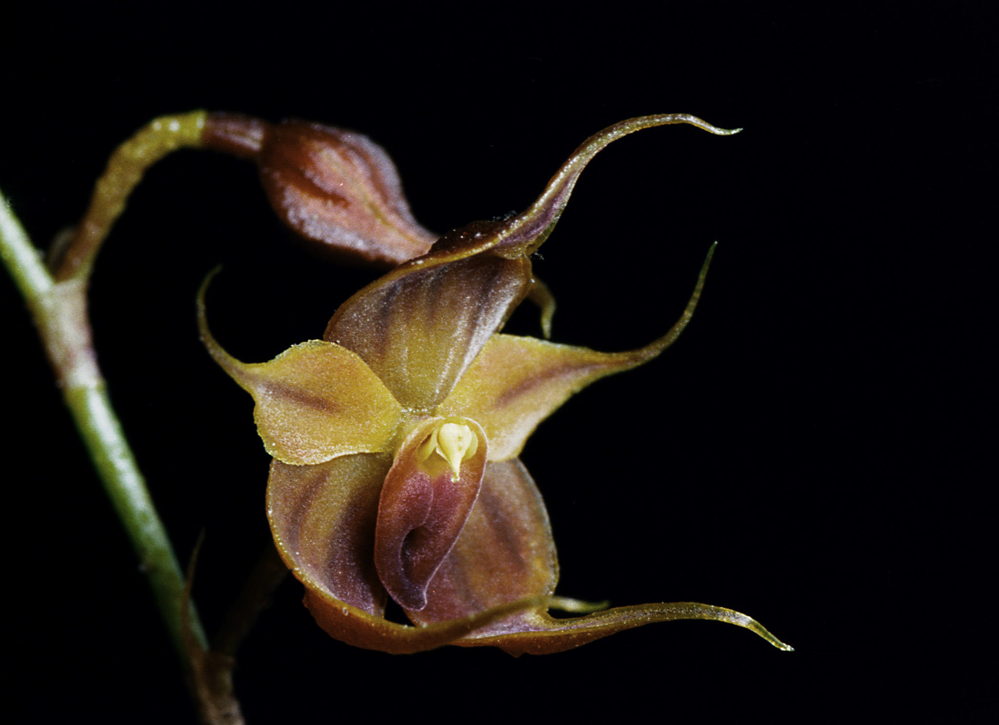
Two new species discovered within the Puro reserve in the eastern Andes of Ecuador have been named after the brand: The Puro Frog, Pristimantis Puruscafeum, discovered by Ranger Juan Palo Reyes, has markings on its skin and coloration reminiscent of a roasted coffee bean. The Puro Orchid, Teagueia Puroana, was discovered by Lou Jost, Founder and Director of WLT partner Fundación Ecominga.
“Through Puro we are trying to do our part in co-creating a more beautiful story… helping to inspire a new way to do business, mindful of all elements involved in the creation of our products”, Andy Orchard, Puro.
CONSERVATION CALCULATOR
Find out how much rainforest you have helped save using the calculator below.
(file download)
The Methodology Behind Our Calculations
The carbon storage calculations are based on the following:
Data access: Global Aboveground and Belowground Biomass Carbon Density Maps for the Year 2010 (ornl.gov)
Rainfall: The rainfall benefits are calculated based on research by the University of Leeds which estimates that each metre squared of intact tropical rainforest contributes 240 L per year in local rainfall. For all areas within a tropical forest biome, forest cover was estimated using the Global Forest Change dataset. Rainfall benefits were allocated for three years following the funding of an acquisition, and any additional years of ranger or reserve management support.
Tree density: The tree density calculations are based on the following paper: Mapping tree density at a global scale
Forest change reference paper: High-Resolution Global Maps of 21st-Century Forest Cover Change (science.org): Mapping tree density at a global scale